Hema Northern Territory State Map (12th Edition)
In Stock - In Stock at Supplier - Item Ships in 2-5 business days
Special Order Item - Terms and Conditions apply.
Need it fast? Contact us to confirm lead times.
Pickup currently unavailable.






Buy Now, Pay Later.


DETAILS
Overview
The whole Territory, from the Top End to the Centre
Driving the Stuart Highway or planning a big NT loop? Hema's Northern Territory State Map shows the whole Territory on one sheet, with camping and rest areas, 24-hour fuel and points of interest marked along the way.

Hema Maps has been mapping Australia since 1983. This edition has GPS-surveyed roads and track updates, fuel stops and historic sites, and camping and rest areas.
What's on the map
Top End to the Red Centre
The main map covers the entire Northern Territory, from Darwin and Kakadu down through Katherine and Tennant Creek to Alice Springs and Uluru, with a full index of towns and places.
- ✓Camping and rest areas
- ✓24-hour fuel
- ✓National parks and points of interest
- ✓Fully indexed

On the reverse

City maps and trip planning
The reverse side has through-road maps of Darwin and Alice Springs and a map of the greater Darwin region. For trip planning there is a national park matrix and contact details for information centres.
- ✓Darwin and Alice Springs through-road maps
- ✓Greater Darwin region map
- ✓National park matrix
Built for touring
Services marked where you need them
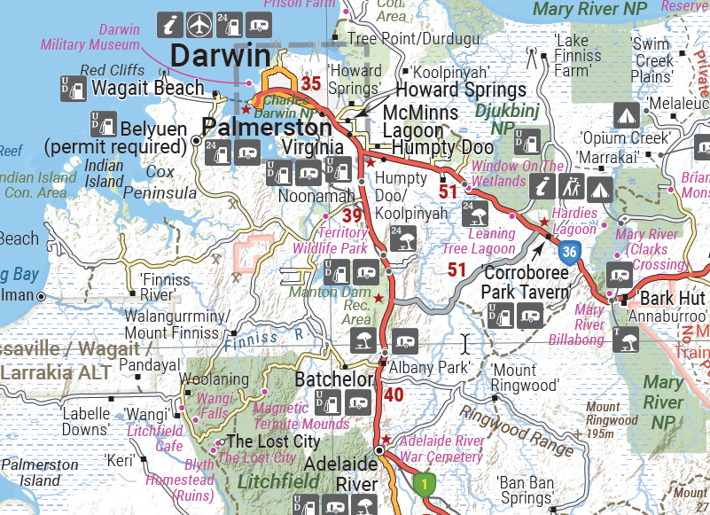
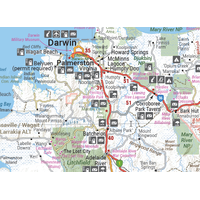
Around Darwin, Palmerston and Howard Springs, the regional map marks fuel, food, accommodation, caravan parks and visitor centres, so you can plan your stops before you set out.
- ✓Visitor facilities marked with clear symbols
- ✓Folds to 140 x 250 mm for the glovebox

Frequently asked questions
Is the map waterproof?
Yes. Hema lists it as printed on waterproof, durable paper.
Which edition is this?
This is the 12th edition, at a scale of 1:1,800,000.
Are there city maps?
Yes. The reverse has through-road maps of Darwin and Alice Springs, and a map of the greater Darwin region.
Is this detailed enough for 4WD tracks?
It is a state touring map. For remote tracks, pair it with a regional Hema map such as the Top End and Gulf or Central Australia maps.
Pairs well with

The Top End and Gulf in detail, with national park insets and 4WD tracks.
$15.95 · View


Features
- ✓Covers the whole Northern Territory
- ✓Camping and rest areas marked
- ✓24-hour fuel and fuel stops
- ✓National parks and points of interest
- ✓Darwin and Alice Springs through-road maps
- ✓Greater Darwin region map
- ✓National park matrix and information centre contacts
- ✓GPS-surveyed roads and tracks
- ✓Fully indexed
Product Details
| SKU | 9321438001508 |
| Barcode # | 9321438001508 |
| Brand | Hema Maps |
| Shipping Weight | 0.0900kg |
| Shipping Width | 0.140m |
| Shipping Height | 0.005m |
| Shipping Length | 0.250m |